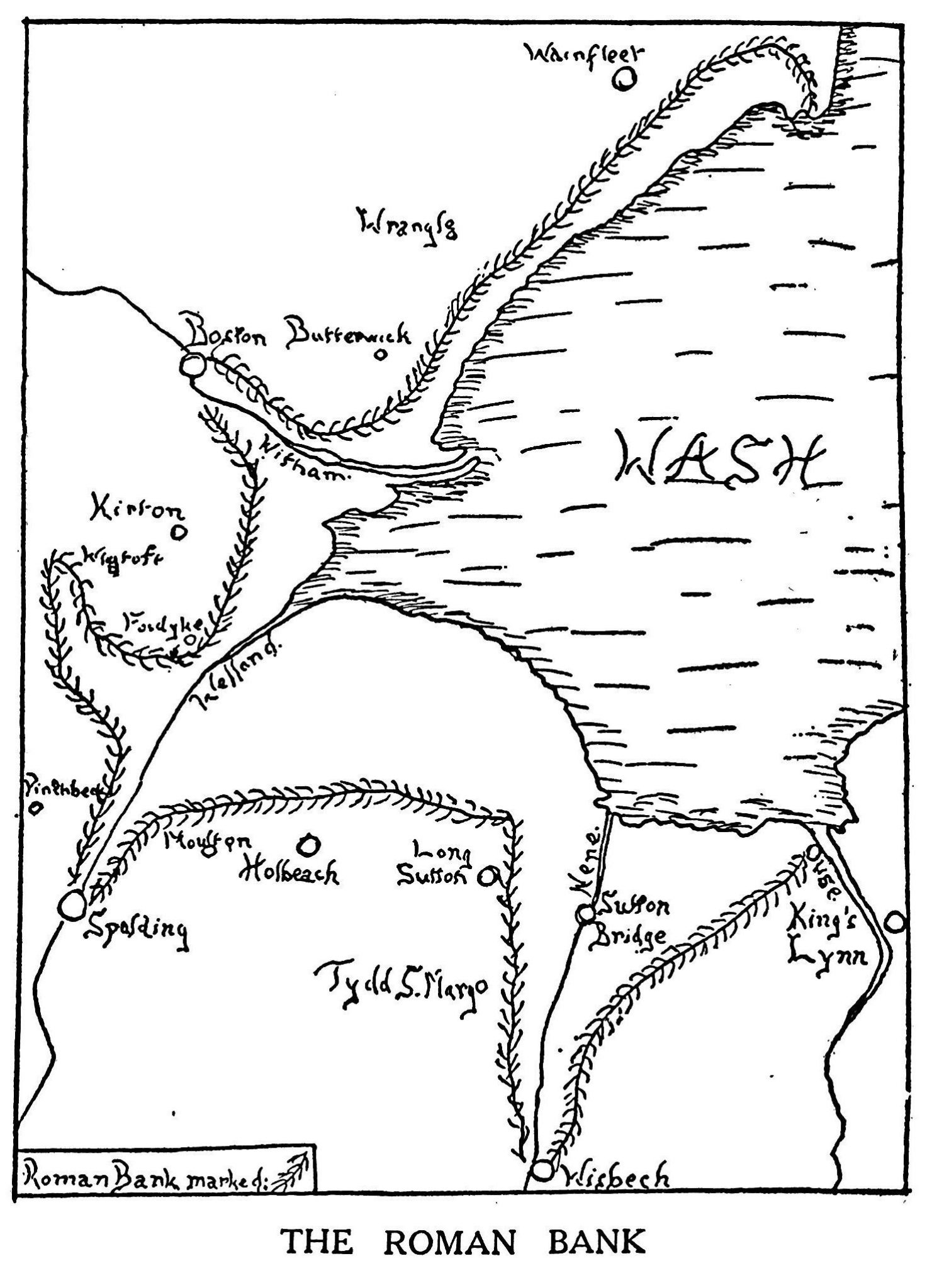
The Romans invaded Lincolnshire towards the end of the first century, and realized that the Fens would be good land for crops when properly drained and that Spalding would be a useful port for exporting them to Gaul. Therefore, they cut many drains (such as the Westlodei and built banks to hold back the sea and confine the mouth of the Welland.
Since the area had only a very small population, the Romans had to import slaves from forergn parts and other counties of England. These, besides draining the countryside, had to build roads and bridges for the transport of troops and the use of the people. A large stone bridge with four arches was erected
on the site of the present High Bridge, which was known for well over a thousand years as the Great Bridge of Spalding. Main roads were normally 60 yards wide, with three lanes; one in the middle for fast moving troops and light traffic and one each side for heavy goods coming and going respectively.
Besides the road at Cowbit, there was one which went along Church Street, Stonegate, Clay Lake Road, and Peck’s Drove to Moulton Austendyke.
However, in the fifth century the Romans had to leave and in later years all their good work was undone by neglect.
Source Historic Spalding
5 responses
“Romans had to teave”
Thanks for correction – Regards Geoff
I walk my dog along the tidal part of the Welland from Spalding towards Surfleet Seas end. On the north west bank of the Vernatt”s drain in places there is an earth bank, I presume this is what is left of the roman sea defences? Locally known as Roam Bank, may be a clue? My guess is the drain followed the line of he old roman sea defence?
This might be interesting
https://www.heritagesouthholland.co.uk/article/spalding-in-roman-era/
Regards
Geoff